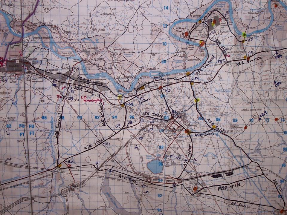
Yesterday I ran across pure gold. This appears to be an annotated operations map from US forces (prob 3/2) in the Al-Qaim area, and it looks like it dates from 2005–at least I don’t see certain battle positions that were set up under 3/6. It was on someone’s Facebook profile.
This helps immensely, as I have been struggling to figure out where all the ASRs and MSRs were. One of the things I’m working on is a Google Earth map of the AO, so if anyone has any amplifying information on this, or (hopefully) has other old maps to share, I’d love to see those.
–Ajax